- Integration of Earth Observation (EO) techniques and Geographic Information Systems (GIS) for model parameterization
- Mapping of geomorphologic land forms and processes with satellite data
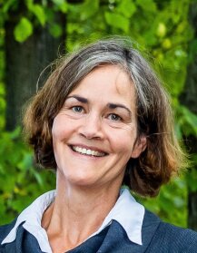
Bettina Böhm (Dipl. Geogr.)

Besides my key areas of research in geoscientific remote sensing, since 2010 I am dealing as research coordinator with the establishment and expansion of innovative R&D networks with partners in the European and in the Asian-Pacific Research Area. Since Feb. 2021 I am involved in the European Universities Initiative "European Campus of City-Universities" (EC2U) being in charge of coordinating activities at Friedrich Schiller University in the work package "Sustainable Cities and Communities".
In addition, I am involved in the preparation, application and implementation of third-party funded projects for national and international funding programs. These activities include self-responsible project presentations at national and international events (conferences, trade fairs, public relations).
Over the past 20 years, I have gained experience in project management including contract design in the national and international environment and have been able to establish a large number of contacts with funding organizations and project partners.
-
Research interests
-
Projects
- since 04/2023 EU: Securing biodiversity, functional integrity and ecosystem services in drying river networks (DRYvER, https://www.dryver.eu/External link)
- since 02/2021 European Universities Initiative: European Campus of City-Universities (EC2U, https://www.uni-jena.de/en/ec2u)
- 07/2019 - 11/2020 BMBF: Increasing the resilience of urban areas and their surroundings to impacts of climate change by integrative management of water resources and water related risks (IRUCOW)
- 11/2015 - 04/2019 EU: Early detection and advanced management systems to reduce forest decline caused by invasive and pathogenic agents (LIFE HEALTHY FOREST)
- 03/2017 - 02/2019 BMBF: Network for Environmental Modeling of Earth Surface Processes: Landslide Hazards in the Context of Climate and Land Use Change (LaCCiLUC)
- 06/2016 - 04/2018 BMBF: Partnerships for the Development of a Flash Flood Warning System (FlashWarn)
- 12/2010 - 06/2016 BMBF: Interdisciplinary network for holistic environment system analysis, eco-system services, integrated modelling and sustainable ressources management (INNO-ASIA); since 07/2015 project leader
-
Service
- Oct. 2022 till today: Member of the Council of the Faculty of Chemistry and Earth Sciences
- Oct. 2022 till today: Deputy of the academic staff in the Senate
- Nov. 2020 till today: Member of the Council of the Institute of Geography
- Oct. 2019 till today: Member of the Senate Committee for Research
- June 2021 till Sept. 2022: Member of the Senate
- Oct. 2019 till May 2021: Deputy of the academic staff in the Senate
- Nov. 2017 till Sept. 2019: Member of the Senate Committee for Research and Early Career
- Dec. 2022 till Apr. 2023: Member of the Interim Evaluation Committe of the junior professorship for Social Geography
- 2020, Aug. till Dec.: Member of the Appointment Committee for staffing W2 professorship for Data Sciences in Biophotonics
- 2018, Jan. till May: Member of the Appointment Committee for staffing W1/W2 professorship for Social Geography
- 2016, Apr. till May: Member of the Appointment Committee for staffing W3 professorship for Physical Geograpy
-
Voluntary activity related to work
- March 2020: Coaching of the regional winners for the state competition Jugend Forscht in Thuringia in the field of Earth and Space Sciences
-
Qualification in the interest of service
- 2017, 2019, 2022, 2024: First Aid trainings
- 2015: First Aid basic training